Croxton Town the history of Southsea

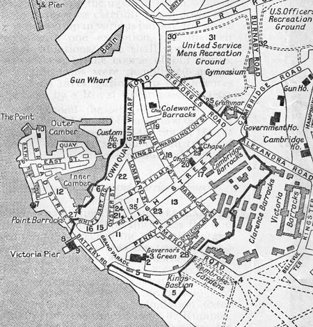
In the early 1800s the town of Portsmouth and the area now known as Southsea looked a lot different than it does today. The town of Portsmouth was contained within the walls of a military garrison as shown in the Charpentier and Co map. There were just four gated entry points into the garrison, these being:
• Landport Gate
• The Quay Gate
• King James' Gate
• King William's Gate
Apart from the garrison town much of Portsea Island was covered in tidal inlets, marshland such as the Great Morass and scattered farms and small holdings.
Thomas Croxton arrived in the area in the early 1800s and bought some farmland from Sir John Carter, part of a local brewing family. The land was not of good quality being close to the Little Morass and drainage was a problem. However, Croxton started building houses which were bought by skilled workers of the Royal Dockyard which was undergoing expansion.
Croxton town
The terraced housing that Croxton developed was located in the area flanked by Hambrook Street at the south, Castle Road to the east, Kings Terrace to the west and Kings Road (formerly known as Wish Street). This area which contains the 'mineral streets' of Stone Street, Gold Street, Copper Street, Silver Street and Diamond Street became known as Croxton Town.
Croxton Town grew rapidly as demand for new housing grew, especially among the middle and upper class families. Croxton responded by building larger, better appointed houses in Wish Street (Kings Road) as well as Landport Terrace, Hampshire Terrace, Bellevue Terrace. Kings Terrace was built on land that Croxton sold to John Williams the Comptroller of Customs.
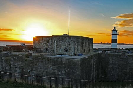
For a long time Croxton Town was the only built up part of Southsea, most people still worked within the garrison town and the area we now know as Southsea Seafront was a wild place where smuggling was rife as late as 1824 an Excise Officer was killed in a fight with smugglers close to Southsea Castle.
The next phase of development saw the building of small houses, arranged in rows, on the land behind Landport and Hampshire Terraces spreading northwards towards the Landport area. These properties were bought mostly by men working in the expanding Portsmouth Dockyard.
In 1823 St Paul's church was built, destroyed on 10th January 1941 during The Blitz, just to the north of Wish Street (Kings Road). Around this area of St Paul's Square a new middle class area developed, including Brougham Road, Kings Street, Norfolk Street and Gloucester Terrace. Some of the buildings can still be seen, but most were unfortunately lost during the air raids and bombing of World War 2.
Between 1831 and 1843 convicts were 'employed' to level the surface and drain Southsea Common the official reason being a military one on behalf of the garrison. But the common was mostly used by influential families of the area to drive their carriages and ride their horses and the improvement works made this much easier and more enjoyable. Until this time the Great Morass and the Little Morass extended north as far as the present day Albert Road making development impossible.
Thomas Croxton died at home at Croxton Lodge, which was located at the north end of Kings Terrace, in January 1826 and is believed to have been buried at St Thomas Church in Old Portsmouth.
Croxton Town remained the main development in Southsea for quite a few years. In around 1820 new houses were built around the Green Road area owned by Mr Somers, later to be known as Somers Town and then in the 1840s Thomas Ellis Owen began building his new developments in the central Southsea area eventually becoming known as the 'Father of Southsea'.
Over time the southern part of Portsea Island became known as Southsea, adopting the name from Southsea Castle, the Croxton Town name becoming used less and less.
Thomas Croxton's name lives on as a street is named after him Croxton Road runs between Pier Road and Victoria Avenue close to the Holiday Inn Hotel, this is possibly the shortest road in Southsea.

